
HunTracker · District mapsPro
Your association's districts, drawn on the map
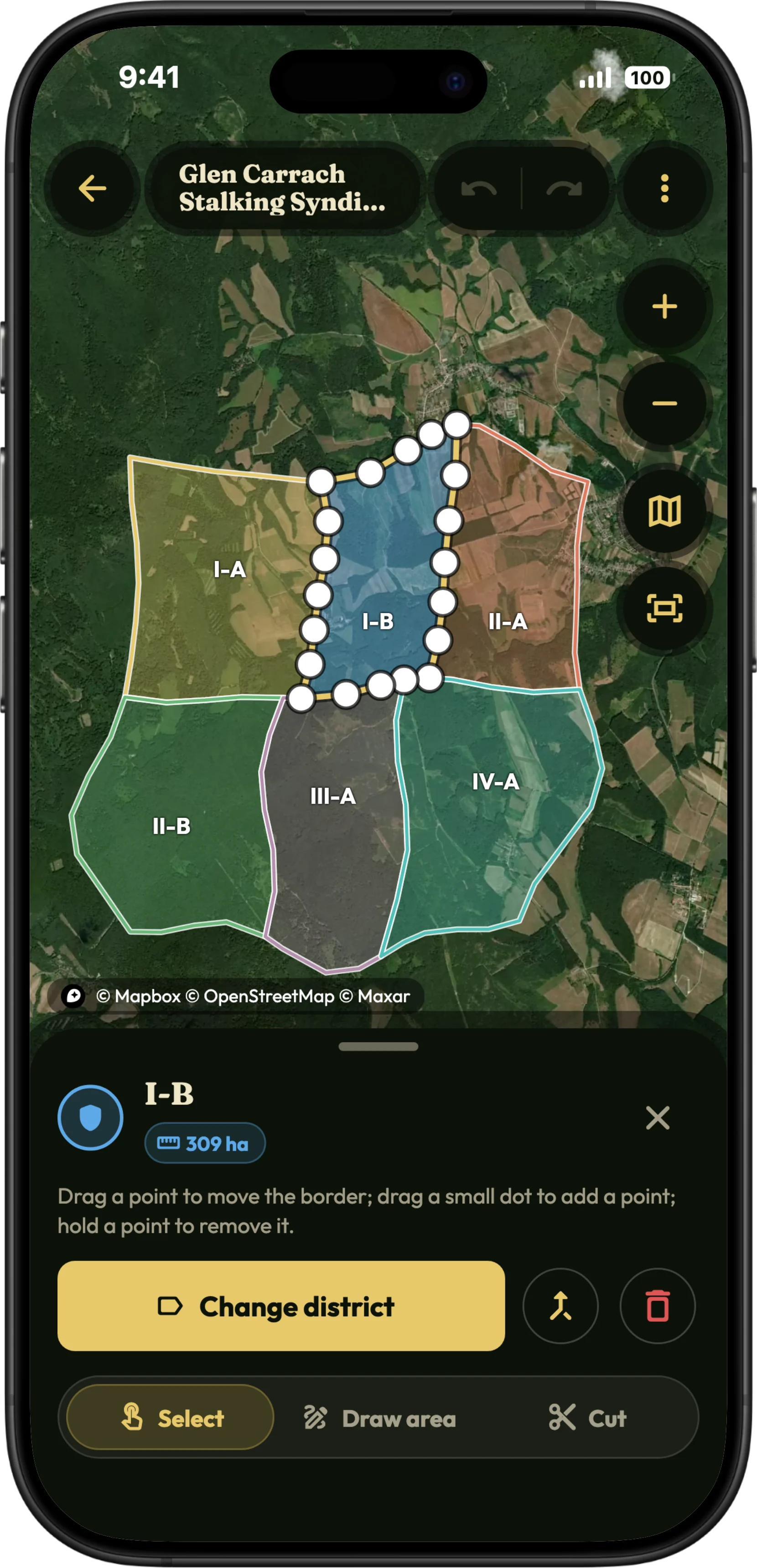
Trace the outer border of your hunting ground once, then cut it into districts, so neighbouring districts share their border exactly. Every hunt's map shows them, and a hunt's district is filled in from where it took place.
Free to download · Free version with no time limit · No ads
What the district map does
Outline, then cut
Trace the association's border once and divide it with cut lines. Neighbouring districts share their border by construction, with no gaps and no overlaps.
Made for a finger and a mouse
Tap points or trace freehand on a phone; on a computer, click, drag, zoom with the wheel and use the keyboard. Any border point can be moved afterwards.
Import and export
Bring in an existing border from a KML, GeoJSON or GPX file, and export your drawing as KML or GeoJSON.
On every hunt's map
Switch the districts on in a hunt's map options: the hunt's own district stands out in gold, the others are outlined.
The district filled in for you
When a hunt starts inside a drawn district, HunTracker fills in its district, so the record is right without a tap.
Shared, view only
Share the map with friends: they always see your latest version on their hunt maps, and cannot change it.
How it works
- Open your association under Hunting associations and start its district map.
- Trace the outer border, or import it from a file.
- Cut it into districts and give each one its name.
- Share it with friends, and switch it on in any hunt's map options.
Free and Pro
District maps are part of Pro: drawing them, sharing them and seeing them on the hunt map. Compare Free and Pro →
Questions and answers
Can I import my hunting ground's border?
Yes. Import a KML, GeoJSON or GPX file, for example one exported from another mapping app, then cut it into districts.
Do my friends see the changes I make?
Yes. A shared map is view only for them and always shows your latest version. You can stop sharing it at any time.
Is the drawing an official boundary?
No. It is your own map, for finding your way and keeping your records straight. The legal boundaries of a hunting ground are the ones the authorities hold.
Start this season's journal.
Free to download for iPhone and Android, with a free version that has no time limit.